


- Indonesia set out to repair its peatlands after a devastating fire season caused an international crisis. The government claims that 3.66 million hectares have been “restored”.
- The government appears to be relying on what experts view as a narrow definition of “restoration”. But even by that definition, its own data indicates the true figure is far lower.
- As another dry season approaches, large areas of peatland may be more vulnerable to burning than government statements suggest.
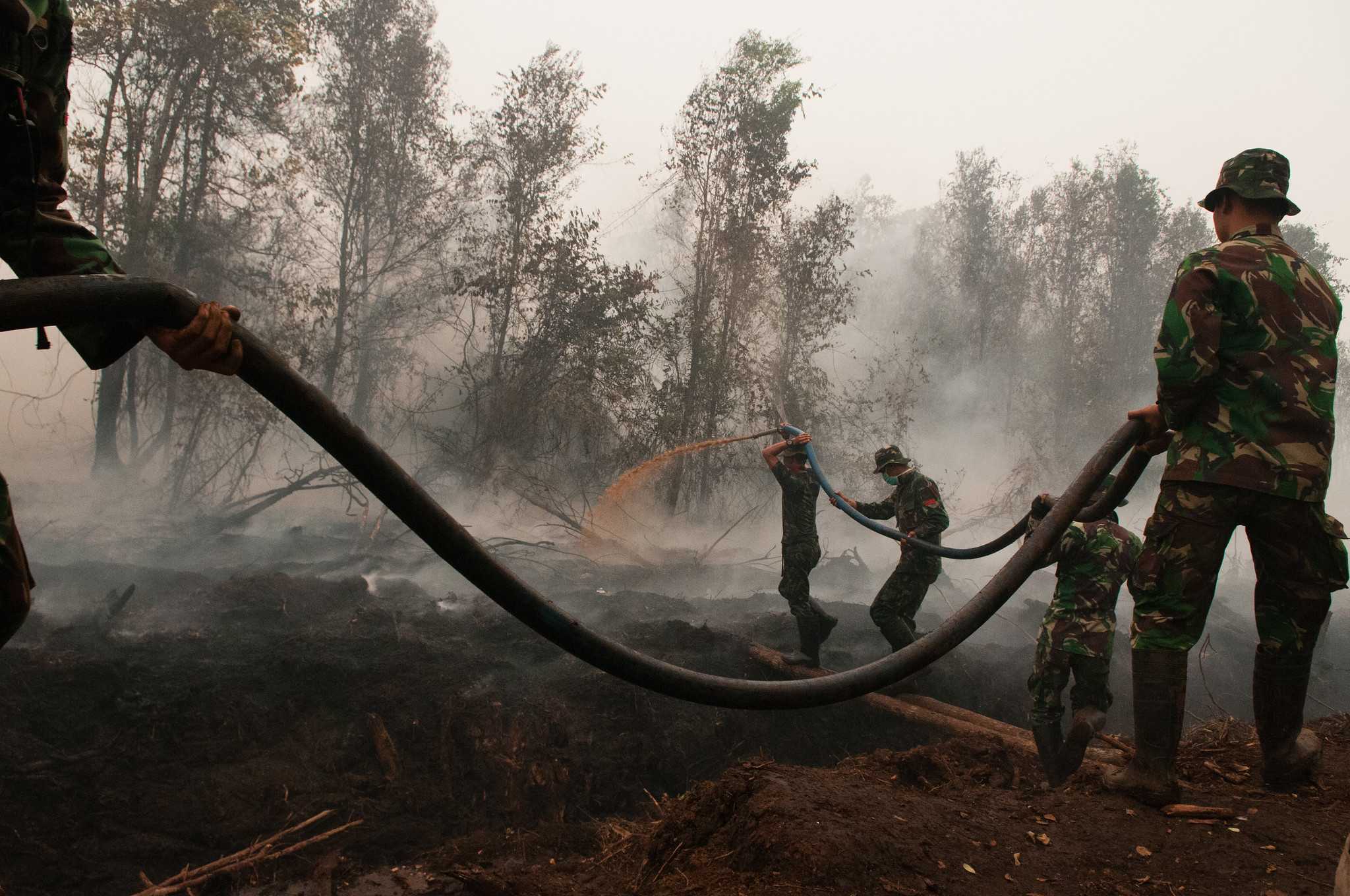
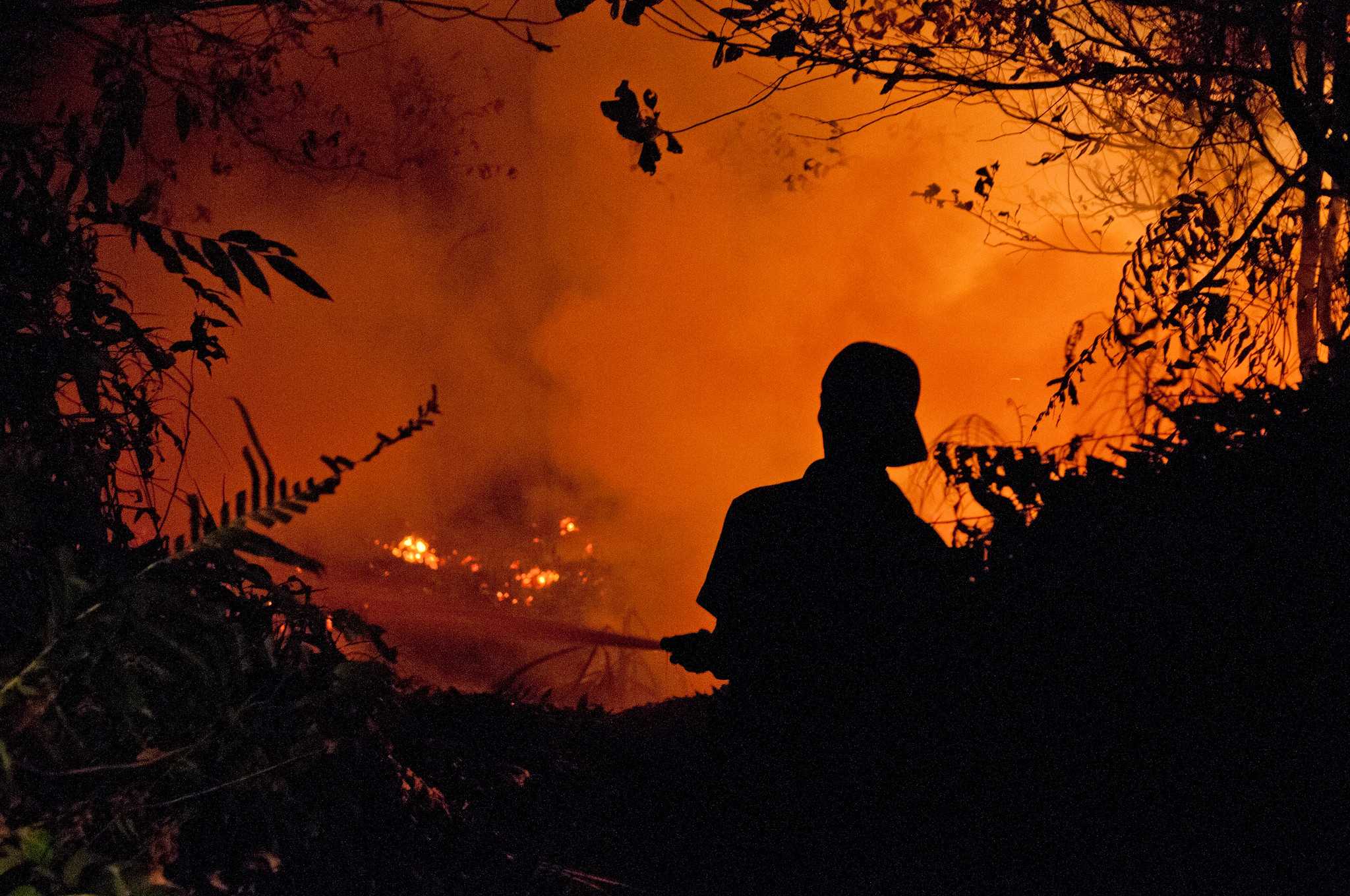
Indonesia’s tropical peatlands became the focus of worldwide attention in 2015 during a notorious wildfire season that devastated swathes of the country.
As flames swept through hundreds of thousands of hectares of peat, they sent up a noxious haze that was blamed for sickening hundreds of thousands of people across Southeast Asia. By the time the dust had settled, the World Bank estimated the crisis had cost Indonesia some $16 billion.
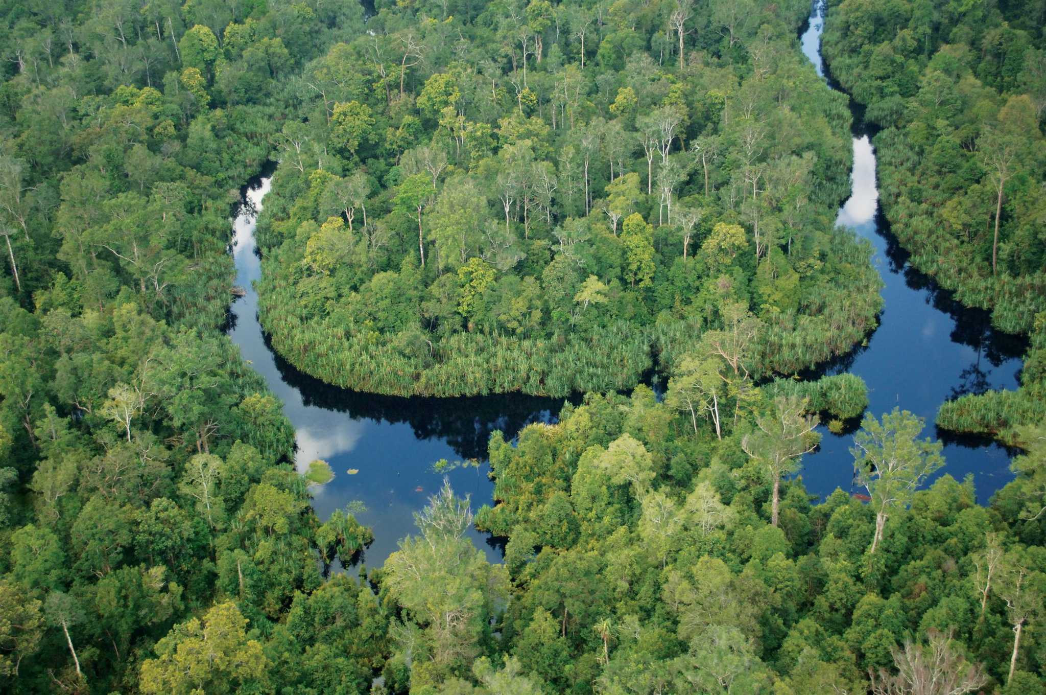
Peatland stores vast amounts of carbon and is waterlogged in its natural state. But years of draining for agricultural development had rendered Indonesia’s peatlands vulnerable to decomposition and burning – releasing greenhouse gases and turning wetlands into a tinderbox.
At the height of the crisis, fires in Indonesia were reportedly releasing more than 15 million tonnes of carbon a day into the atmosphere – more than the daily output of the entire US economy at the time.
The 2015 fires prompted President Joko Widodo to launch an ambitious plan to restore the nation’s peatlands, an effort that has become a cornerstone of Indonesia’s climate change mitigation strategy.
The Indonesian government claims to have made huge progress in this endeavour, with as much as 3.66 million hectares of peatland declared “restored” in areas managed by plantation companies. But these claims are not supported by data the government has made public, an analysis by The Gecko Project has found.
The government's statements appear to hinge on a narrow definition of “restoration” that deems peatlands restored when groundwater levels have been raised to 40 centimetres below the surface. Our analysis of government data indicates that even by this measure, the areas “restored” have never reached the figures cited in official documentation and may in fact be far lower.
The data also shows that the area of peatland that meets this 40cm threshold also fluctuates wildly as water levels rise and fall, sometimes dropping as low as half a million hectares – a fraction of the area claimed as “restored” by the government. Data reviewed by The Gecko Project indicates that many timber plantation companies are sitting on peatlands in which water levels have been below 40cm for much of the past year.
The Indonesian Ministry of Environment and Forestry did not respond to written questions, or to extensive attempts to seek comment on our findings.
Environmental researchers who spoke to The Gecko Project viewed the implementation of a system to monitor peatland restoration as a positive step. But some also expressed scepticism about the government’s claims of success and how it was arriving at its figures.
In the meantime, with Indonesia heading into what meteorologists predict could be an extreme dry season this year, the findings suggest that large areas of peatland could be far more vulnerable to burning than the government has acknowledged.
The coming months, said David Taylor, a professor and peatland expert at the National University of Singapore, would serve as “a good test” of the government’s claims.
The repair job starts
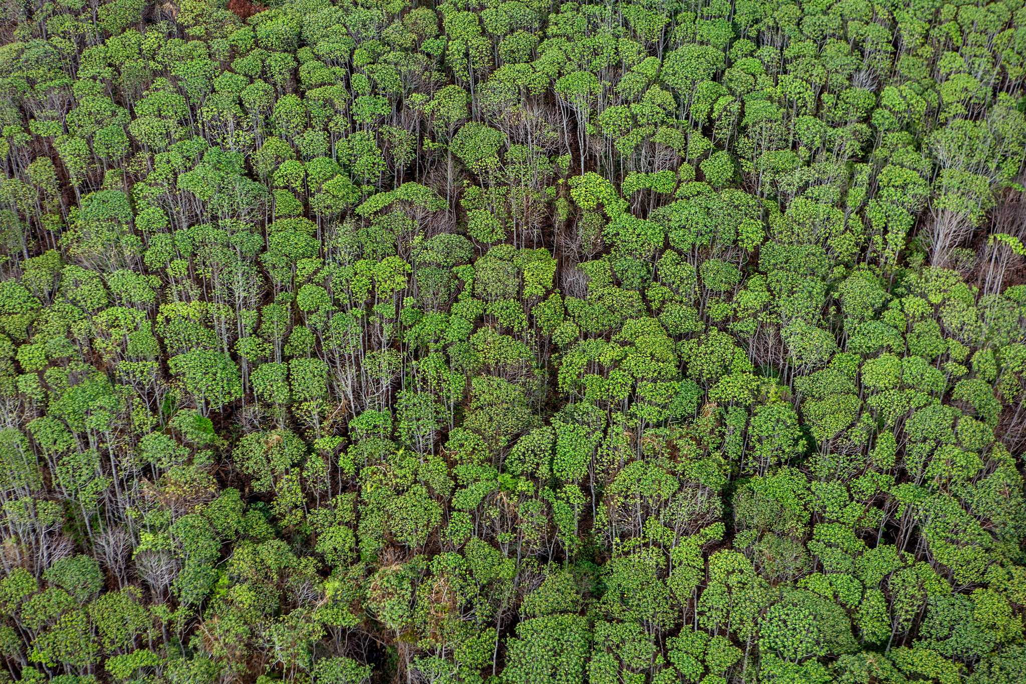
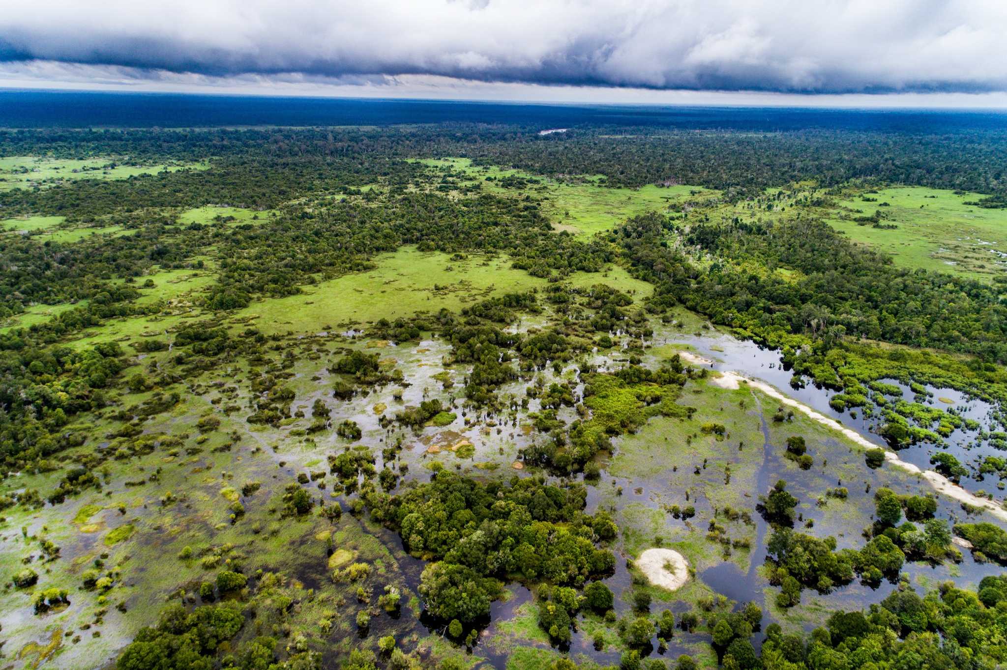
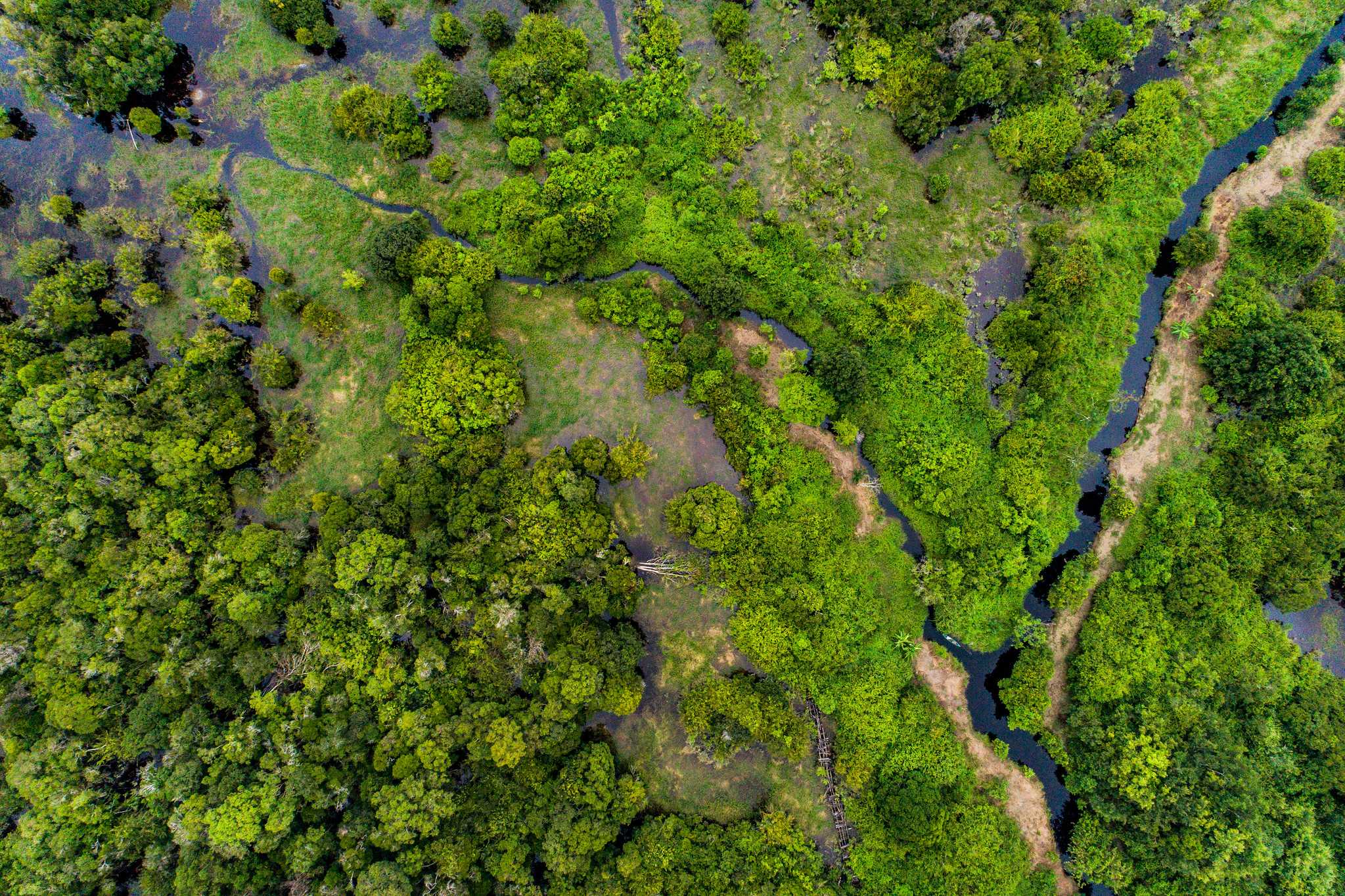
Despite covering only around three percent of the planet’s land surface, peatlands store around a third of all the world’s soil carbon. In Indonesia, where they cover more than 20 million hectares, peatlands have long been prone to fire during the dry season.
Blame for starting fires has been put at the door of small-scale farmers practising indigenous slash-and-burn agriculture, to plantation conglomerates systematically setting fire to clear forest, and even to local residents carelessly disposing of cigarette butts. The risk of fires spreading is greater when the country experiences a strong El Niño event, as it did in 2015, during which the climate west of the Pacific becomes unusually dry.
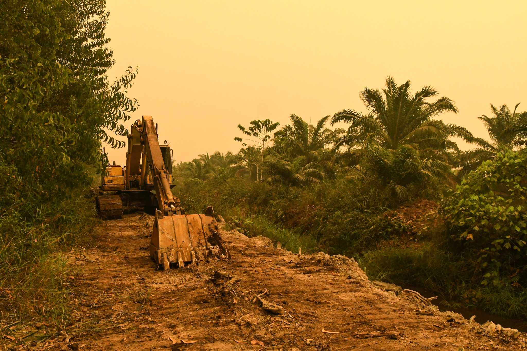
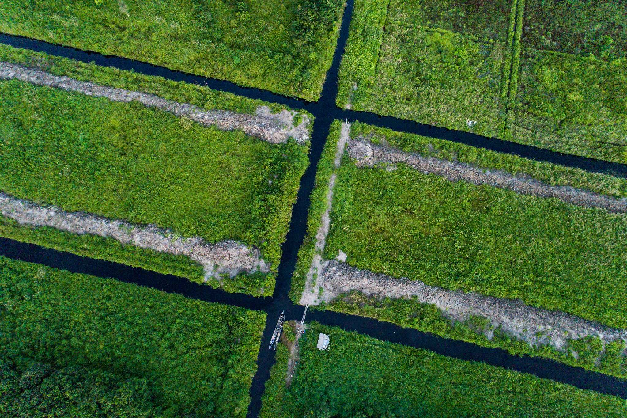
The conditions that allow fires to proliferate have grown worse as peatlands have been deliberately drained by digging networks of canals to enable the development of oil palm and timber plantations.
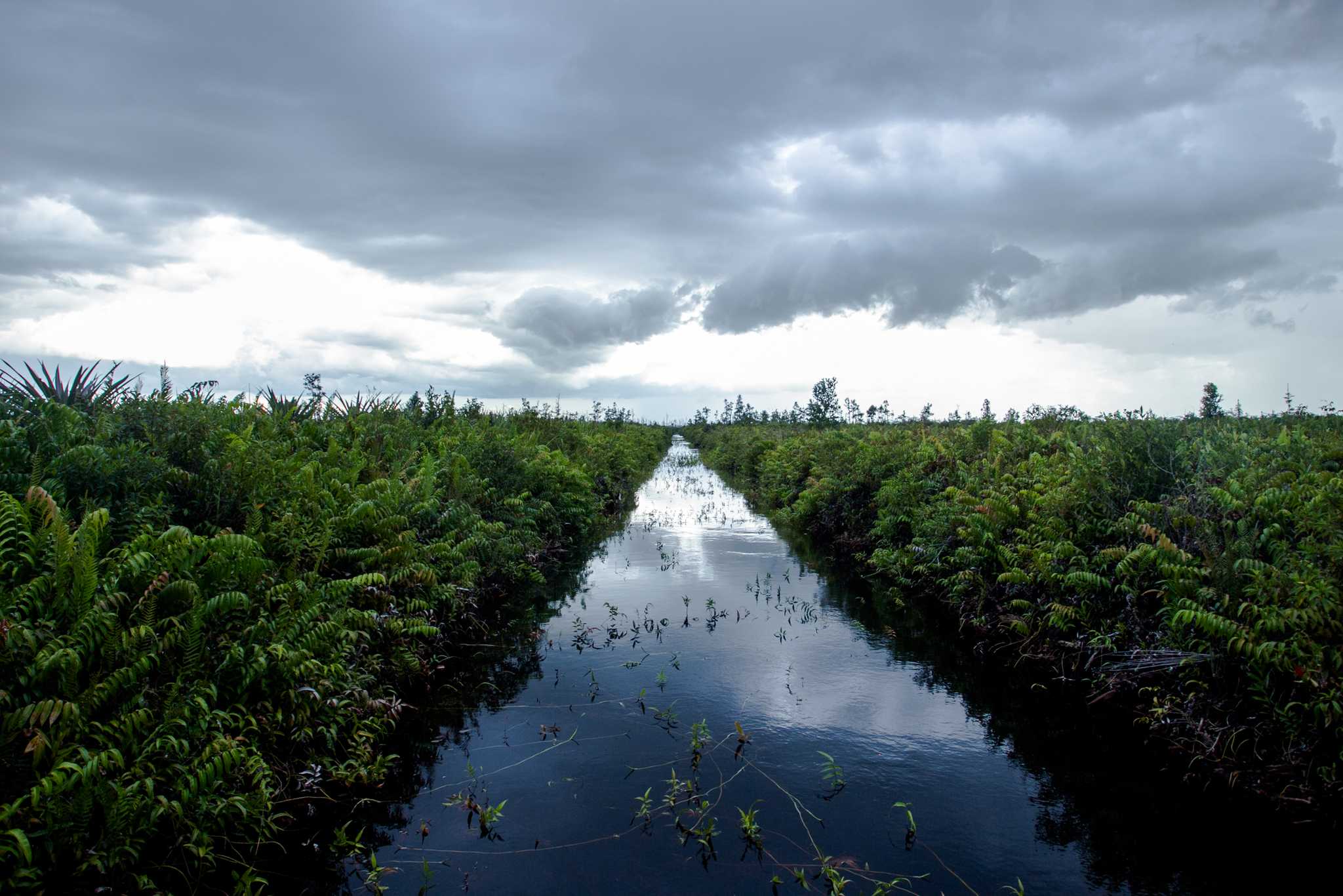
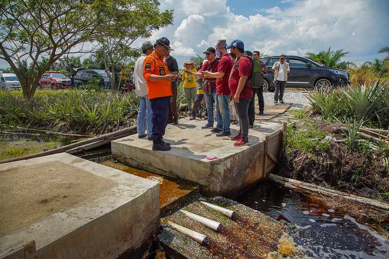
The government set out to undo some of that damage by issuing a series of decrees and regulations, beginning in 2016. Technical documentation described how blocking canals would help raise groundwater levels to rewet the peat and reduce fire risk, while replanting typical peat vegetation would bolster peatlands’ natural functions, such as water retention, filtering, and carbon storage.
According to these guidelines, success would be assessed through multiple metrics, including the density of plant growth on rehabilitated peatlands and the achievement of a groundwater level of no lower than 40cm below the surface of the peat. Some research has suggested that reaching this 40cm threshold substantially reduces fire risk, and that higher water levels offer better protection.
A specially-established government body, now named the Peatland and Mangrove Restoration Agency, or BRGM, was given authority for overseeing peat restoration in land controlled by communities or the government.
However, several million hectares of peatland falls within land already licensed to plantation companies. These companies were given responsibility for restoring peatland within their concessions, and were required to provide updates on their progress to the Ministry of Environment and Forestry, known as KLHK.
Mission accomplished?
According to KLHK reports, work in the companies’ concession areas has progressed at speed – although specific claims of success vary depending on where they have been reported. The KLHK website, for example, states that 3.4 million hectares of peatland within concession areas were “restored” between 2015 and 2019.
A 2020 report prefaced by Environment and Forestry Minister Siti Nurbaya Bakar lists cumulative totals of 3.11 million, 3.26 million, and 3.64 million hectares restored in 2018, 2019, and 2020 respectively. A KLHK update from 2022 states that “the restoration of peatland ecosystems in concession areas continues to increase and as of December 2021 had reached 3.66 million hectares.”
Indonesia is already reaping rewards from this work, according to claims by ministry officials. Although fires again swept through Indonesia in 2019 after a weak El Niño event, there were no forest fires that year “in peat areas that had been intervened by wetting, or in peat areas that were restored,” M.R. Karliansyah, KLHK’s Director General of Pollution Control and Environmental Damage, reportedly told a meeting about fire prevention in South Sumatra province.
KLHK has also claimed that by 2019, rewetting work alone had already reduced carbon dioxide emissions by more than 190 million tons – equivalent to the annual national emissions of the United Arab Emirates. KLHK did not respond to questions about the data supporting these calculations.
“It’s very difficult to see how the peat could have been considered to have been restored”
Based on its own reports, KLHK’s approach to restoration appears far narrower than early regulation implied. Ministry documentation repeatedly states that companies are required to raise peat groundwater levels to at least 40cm belowground.
But other phases of restoration work, such as replanting native vegetation, appear to have been sidelined, leaving “rewetting” to be used as a proxy for restoration. In a 2019 press release, for example, KLHK stated that it had successfully guided concession holders to carry out restoration “by rewetting” for 3.1 million hectares of peatland.
In a 2022 report, where the ministry describes a restored area of 3.66 million hectares, it mentions more than 10,000 groundwater measurement points, and more than 30,000 constructed canal blockings – measures associated with rewetting. But fewer than 6,000 hectares are registered as having “vegetation rehabilitation,” according to the report, implying that these areas contribute very little to the total “restored” area.
Indeed, more than half of Indonesia’s peatlands have what is known as a “cultivation function”, meaning that they can still be exploited by plantation firms. In some cases, plantation companies can plant even on peatlands that have a supposed “protection function”.
“In areas where the peatland has been exploited, where the exploitation is continuing…it’s very difficult to see how the peat could have been considered to have been restored,” said Taylor, the professor at the National University of Singapore.
KLHK did not respond to requests for comment about which restoration techniques it prioritises.
Comparing government data with government claims
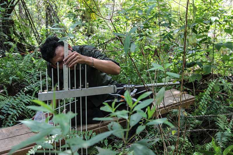
KLHK has not made public a list of areas deemed to be restored and did not respond to requests for this information. However, it has published data on areas that have been rewetted to various levels – along with company concession and peatland maps – on an online app launched as part of a suite of tools purportedly designed to boost transparency and accountability.

Using data downloaded from this app, The Gecko Project was able to identify areas of peatland within more than 290 concession areas, assess whether water levels in these areas have changed over time, and compare the area rewetted to the 3.66 million hectares that KLHK claims has been restored.
That analysis revealed that the average area registered as rewetted to the required 40cm level has hovered around 2.7 million hectares since 2018, and has not increased over time. Across 2020, for example, an average of around 2.7 million hectares of peatland were registered by KLHK’s app as having a water level of 40cm or above; in 2022, the average area rewetted was around 2.6 million hectares.
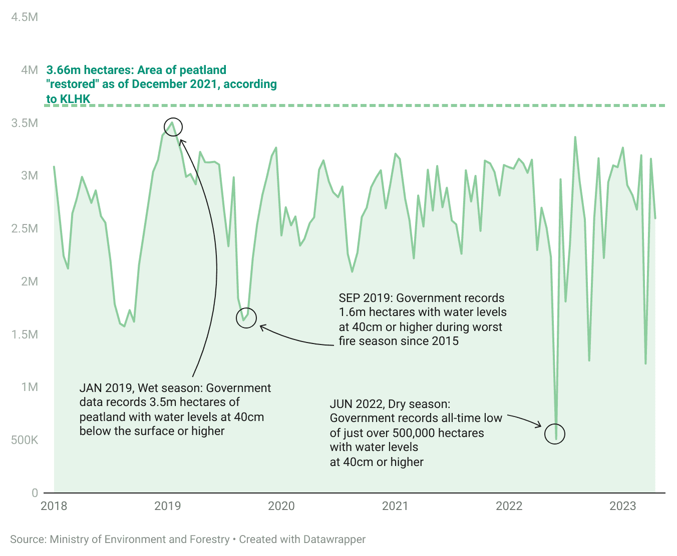
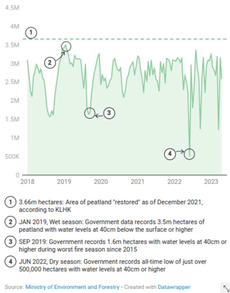
Examining government data on a shorter timescale reveals substantial fluctuations in the area of peatland registered as “rewetted”, suggesting that water levels are not being maintained on a stable basis.
At the beginning of 2019, during a wet season that saw torrential floods in many parts of the country, KLHK registered that around 3.5 million hectares of peatland inside concession areas had groundwater levels at 40cm belowground or higher.
But in the middle of the 2022 dry season, the area rewetted was down to around just half a million hectares.
Level up
Our analysis also identified multiple concession areas in which government data shows water levels as being consistently below 40cm in the past 12 months, highlighting a possibly heightened fire risk as this year’s El Niño event progresses.
As an example, The Gecko Project considered concession areas with water levels registering below 40cm on more than half of their peatland. Between September 2022 and April 2023, more than 50 concession areas met this criterion at least 50 per cent of the time, and 11 met it at least 75 per cent of the time.
PT Rimba Hutani Mas, a pulpwood plantation company and supplier of the major paper and pulp firm Asia Pulp & Paper (APP), manages nearly 70,000 hectares in South Sumatra province, the majority of which is on peatlands according to government maps. The company was subject to legal action by Singapore’s National Environment Agency after evidence emerged that fires in its concession had contributed substantially to the haze of 2015. APP argued at the time that almost all the fires in its concession areas had been started outside those areas.
KLHK data during the last year shows large sections of PT Rimba Hutani Mas’s peatland with water levels below the 40cm threshold. According to KLHK, concession holders that have groundwater at this level “should carry out field checks immediately and improve or repair water management infrastructure in the field.”
According to government data, water levels in PT Rimba Hutani Mas' concession area were regularly more than 40cm below the surface between September 2022 and April 2023.
APP did not respond to specific questions about water levels in this supplier’s concession area, or in that of two other APP suppliers. The company said it has been submitting “all the required data” to KLHK and pointed to its 2022 Sustainability Report.
Another concession where government data has shown consistently low water levels since last summer is that of PT Seraya Sumber Lestari, in Riau province on the island of Sumatra. The concession holder is a supplier of another pulpwood giant, APRIL, and has previously been sanctioned by the Indonesian government for a fire on its land.
According to government data, all of PT Seraya Sumber Lestari’s 20,000 or so hectares fall on peat, yet in recent months water levels in the concession have regularly been more than 40cm below the surface.
APRIL told The Gecko Project in an email that it and its suppliers aim to maintain water levels “around the 40cm target”. Responding to specific questions about PT Seraya Sumber Lestari, APRIL said the concession’s water levels could likely be explained by variations in rainfall. When there is above-average rainfall, the company said, water levels would rise.
APRIL also claimed that PT Seraya Sumber Lestari keeps its peatland “moist” irrespective of water levels, adding that “years of ground experience and extensive fire data indicate no correlation between water table and fire risk in well managed plantations”.
“It’s very difficult to maintain the water table”
Peat researchers who spoke to The Gecko Project say that substantial fluctuations in water level on peatland are to be expected, whether or not land is being managed, complicating the use of groundwater level as a standalone measure of restoration success.
Water levels are highly dependent on external climate conditions, noted Muh Taufik, a tropical peatland researcher at IPB University. In the wet season, the water table could be at ground level or even above ground, while in the dry season it can fall to a metre or more below the surface, he said.
The topography of the land itself can influence the water table, too – valleys are more likely than slopes to remain wet. Against these external conditions, rewetting infrastructure such as canal blockings (which are often built from wood and need regular maintenance to keep functioning) can be a relatively blunt tool. “It’s very difficult to maintain the water table around 40cm,” Taufik said.
Such variability reinforces some researchers’ concerns about judging restoration success on the basis of water level data alone – particularly if a high water table is only a fleeting occurrence, as government data suggest it was for many areas in early 2019.
While getting water back into dried-out peatlands is important, “it’s definitely not ‘job done’” once the water table reaches 40cm, said Dominick Spracklen, a professor of biosphere-atmosphere interactions at the University of Leeds. Rather, he said, “it is a good proxy for things moving in the right direction.”
David Taylor, the peatland expert, suggested that rewetting should be seen as a first step. “It goes back to that initial problem with how you define restoration,” he said. “If it’s just that for a temporary period of time during the year, the water table is above 40cm, for most people that’s not peat restoration.”
Taylor added that although rewetting helps reduce carbon dioxide emissions by lowering the rate of peat decomposition, these effects can take years to kick in and are often accompanied by increases in methane, another greenhouse gas.
While having a monitoring system for peat rewetting is a positive step, he said, it’s important to take a more holistic approach to peat restoration that acknowledges the time and multiple steps involved – particularly reintroducing plants and allowing natural vegetation to grow in the absence of peat-damaging plantation activities.
“There is still doubt”
Several researchers who spoke to The Gecko Project questioned the value of the data KLHK has made publicly available. The ministry’s app only presents maps, not the original database of individual measurements from monitoring stations that underpin them.
“The method [used to make the maps] is not mentioned in this system,” said Gusti Anshari, a tropical peat expert and professor at Tanjungpura University. “It’s very difficult to assess.”
Taufik, the IPB researcher, said that this could create a misleading picture, depending on how the government had gone from those individual measurements to estimating water levels across wider areas. If a monitoring station is placed at the wettest part of a concession area, he said, it would likely fail to capture the dryness of areas around it, making it an unreliable indicator of the health of the whole peatland.
“I think the government should open the [complete] data[set] so the public or scientists will believe that the data is correct, so we will believe that the restoration project is successful,” he said. “If the government is not making it public or open, I think there is still doubt.”
Some observers noted that the area claimed as “restored” by the KLHK approximately matches the area of peatland within concession areas in the app. Agiel Prakoso, a research manager at Pantau Gambut, a nonprofit focused on sustainable peat management in Indonesia, said that the government's 3.6 million hectares claim may refer to the area in which companies have taken some action – such as building infrastructure for rewetting – or the area for which water levels are being monitored.
KLHK did not respond to requests for comment. But it has published information that seems to leave open this possibility. One 2023 report by the ministry described the Indonesian government’s improvements in “peatland governance including its water management which covers an area of 3.4 million hectares” – the same area that it claimed as successfully restored back in 2019.
Gusti, the professor at Tanjungpura University, suggested KLHK’s figures could be meant as targets rather than statements of what has been done. “It’s very complicated [to determine] whether this number has been achieved or not,” he said.
Separate KLHK documents appear to acknowledge much lower success rates than claimed by officials. A 2020 report, for example, noted that of 280 concession areas under the ministry’s purview, 261 had submitted peat restoration plans by 2019. Yet, the report said, a “performance assessment” of those companies that inspected infrastructure and groundwater levels concluded that just 60 “were found to have actually improved their performance of peatland ecosystems management.”
Indeed, fieldwork published in 2021 by the nonprofit Pantau Gambut concluded that “most companies” had failed to implement plans to restore peat.
The implications of these failings, and the fluctuations in water levels, may become apparent in the coming months, as dry weather continues to intensify in Indonesia in the first El Niño year since 2019. In mid-June, KLHK reported that fires in 2023 had already affected more than 28,000 hectares of forest and other land.
“Big El Niños over the last thirty years or so have been associated with drought here in southeast Asia [and with] peatland fires,” said Taylor. Fires can burn even on pristine peatlands, he said, but if Indonesia’s restoration work has been successful, it should help limit some of the damage. “I think it’s going to be a test of claims that have been made that these peatlands have been restored.”
Sign up to our mailing list here.
Header image: Peatland forest in Parupuk village, Central Kalimantan. By Nanang Sujana/CIFOR, CC BY-NC-ND 2.0. All images by CIFOR are available here.
Graphics by Thibi.